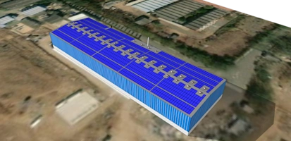

Most construction rework shouldn’t start in the field. It needs to start in the model. By bringing context from site scans and BIM models into your design process early, contractors can avoid some of those in-field adjustments that become expensive change orders. The difference between change by click or by a frustrated field crew isn't access to information. It's timing.
Here are three essential workflows you can use in SketchUp to bring clarity to your project before you even begin modeling.
Workflow #1: Add real-world location
Too often, projects begin with isolated geometry and add context later. Start the other way around.
Use Add Location to import terrain, aerial imagery and surrounding conditions directly into your project file. Instead of working in abstraction, you begin with real elevation and topography, along with the surrounding site constraints.
When you start this way, you can:
Visualize elevation and topography before grading begins
Understand how surrounding structures affect access and staging
Align early logistics discussions with actual terrain conditions
For example, when preparing for site grading conversations, you can evaluate slopes and elevation changes before committing to a strategy. Early assumptions turn into informed decisions.
Best used when:
You're planning site layout, evaluating grading approaches, or coordinating early urban or civil context.
Workflow #2: Bring Point Cloud data into your working model
Once geographic context is in place, bring in scanned reality.
With Scan Essentials, you can bring Point Cloud data directly into SketchUp instead of reviewing scans in a separate viewer. That means you evaluate design ideas against actual site conditions—inside the same working model.
Use Clipping Boxes to isolate key areas and keep navigation of large point clouds manageable. Instead of navigating millions of points at once, you focus only on what matters in the current discussion.
This allows you to:
Overlay proposed access routes onto existing terrain
Validate clearances before mobilization
Identify constraints early—before they become costly field revisions
For example, when reviewing temporary access, you can compare your proposal against scanned topography and detect conflicts before equipment arrives on site.
And when you're ready to collaborate, save or share your model through Trimble Connect so teammates can review the same context without working from disconnected files.
Best used when:
You're working with existing-condition data, renovation projects, or preconstruction validation.
Workflow #3: Import IFC models
When you import an IFC model into SketchUp, element classifications and associated metadata—such as materials and quantities—remain intact. Walls stay walls. Beams stay beams. Materials and quantities remain accessible.
From there, use Tags and Scenes to control what information is visible and tailor focused views for specific conversations, such as site logistics, construction sequencing or coordination reviews. For example, a project manager might prepare:
One model view for subcontractor site access
Another focused on crane placement for the engineering team
Another for sequencing discussions
Instead of presenting every detail at once, you can guide stakeholders through focused views that support decision-making.
When you combine structured model views with shared access through Trimble Connect, coordination becomes more transparent and less fragmented.
The model becomes a communication tool—not just documentation.
Best used when:
You're coordinating across disciplines, preparing structured reviews, or aligning design intent with field conditions
Extend the workflow: Test Civil Scenarios in 3D
When solid geometry derived from terrain and point cloud data lives in one place, you can test scenarios instead of debating them.
Use Create Ground Mesh and Solid Tools to build editable terrain and compare grading alternatives. Measure excavation volumes. Undo and adjust without starting over.
For example, simulate two grading strategies and reverse one without impacting earlier work. No duplicate files. No lost progress.
That's when the model becomes a problem-solving tool.
Start every project right
If you take away three things, make it these:
Maximize your data sources. Bring in context early so decisions are grounded in reality.
Organize so you can visualize. Structure the model to guide conversations instead of overwhelming them.
Use the model to solve problems. Work things out before they become field issues.
If you'd like to see how these workflows connect from beginning to end, watch the full session:
Start any project right: Master data and context imports in SketchUp
Pick one workflow and use it on your next project start. Most project friction doesn't come from lack of effort. It comes from a lack of shared context. Start there—and build from clarity.