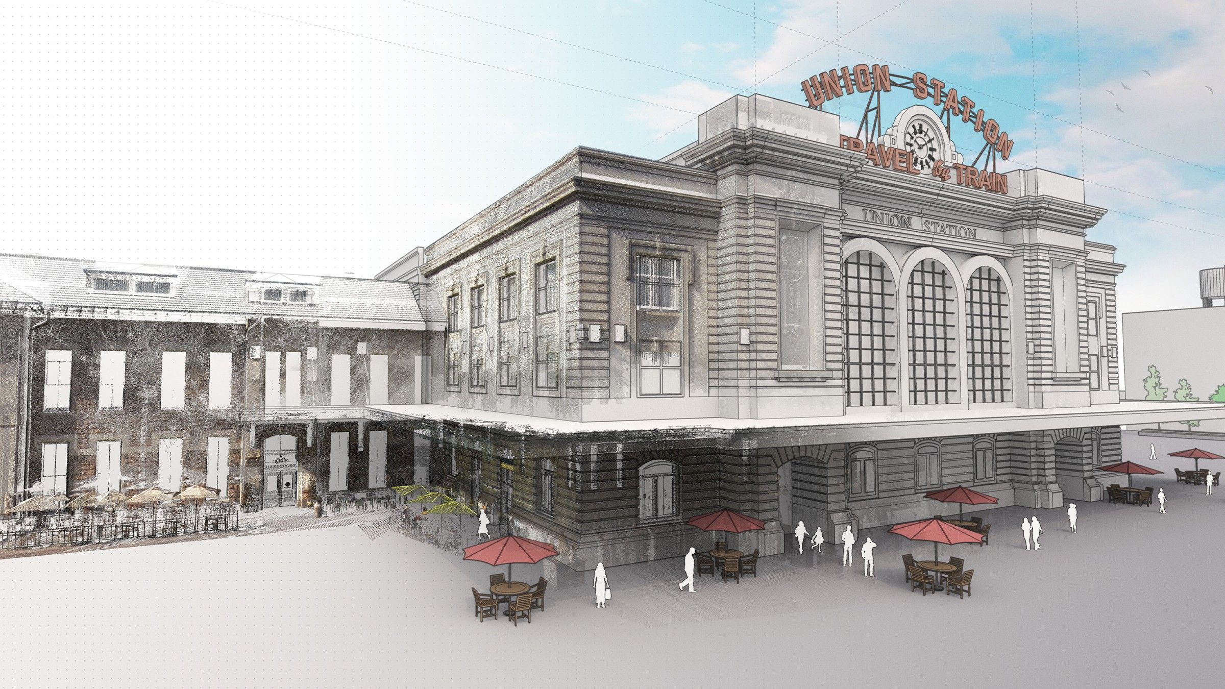
Who’s ready for some good news? It wasn’t that long ago that we announced the integration of Trimble’s Scan Essentials with SketchUp, and the positive response has been astounding. That’s why we are thrilled to announce that Scan Essentials (a Windows-only extension) is now included in our Studio subscription! This addition comes with a few new features to boot. That’s right, if you’ve already subscribed to SketchUp Studio, bringing point cloud files into SketchUp just got so much easier.
If you’re not familiar with Trimble’s Scan Essentials, let’s get you up to speed. Scan Essentials is an extension that adds a ton of value early on in your workflow because it lets you import, view, and model directly on point cloud data in SketchUp—accurately capturing the “as-built” condition of your project. It equips first-timers and pros to quickly turn rich point cloud data into accurate 3D models with ease through a variety of file formats (E57, RWP, LAZ, TZF, LAS, PLY). You no longer have to waste time painstakingly modeling contextual details—simply import your point cloud, and model directly on it using SketchUp’s native toolbox.
By leveraging Scan Essentials, you’ll see an increase in workflow efficiency, better integration between project stages —from site surveys to design, construction, and post-construction—supporting greater success on complex projects. Here are some of the top features that we’re especially excited about:
Model directly on the point cloud for precise drawings
Adjust color and transparency with the intuitive Point Cloud Manager
Compare your model against the point cloud to ensure model accuracy with the Inspection tool
Zoom in and focus on specific sections with the Clipping Box
Simultaneously view all your scan data and 3D models in the field
Create section views with the advanced toolbar
Align scan data with your model
Add point clouds with ease using the Rotate and Move tool
Significantly speed up your modeling process by incorporating configurable 3D Warehouse models onto your point cloud
Document point cloud data in 2D by exporting directly to LayOut
View some of the features in action:
Featured (in order of appearance): Inspection tool, LayOut integration, Move tool, Clipping Box, Section & Visualization Modes, Point Cloud Manager. House image courtesy of Marco Chiarello.
Scan Essentials also plays nice; it is interoperable with a wide range of industry hardware and software including all of Trimble’s 3D laser scanners, other laser scanners, and even photogrammetry datasets from drones!
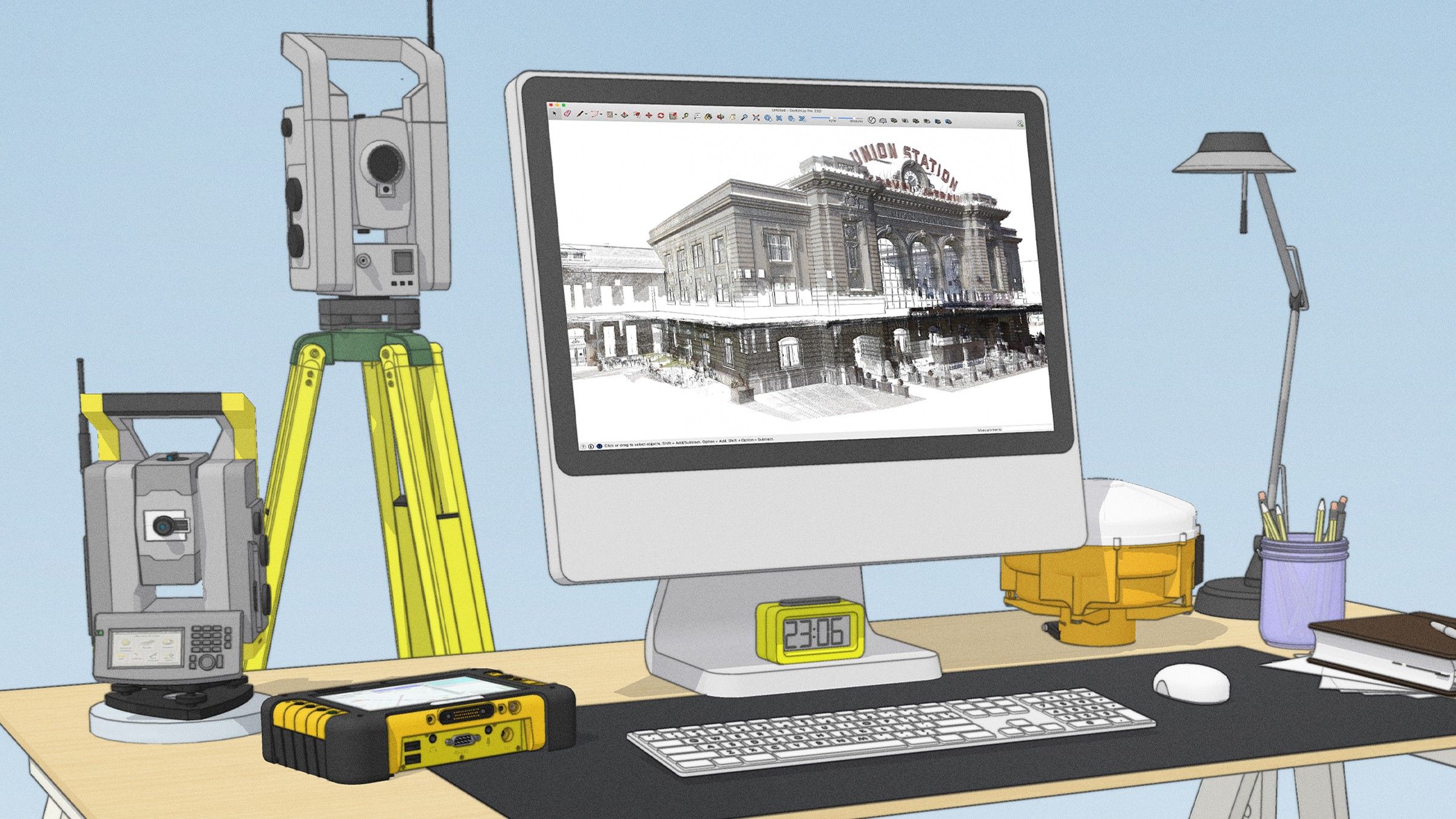
Don’t have access to laser scanners or drones? No worries. With Scan Essentials, you can import PLY file formats generated from scanning applications on mobile devices (e.g. iPhone 12 and iPad Pro). Scan Essentials truly makes the scan-to-BIM workflow accessible to everyone.
Visual learner? See how to use Scan Essentials in your workflow.
SketchUp + Scan Essentials In Practice
We knew importing point cloud data would facilitate some incredible workflows, but as always, we are so impressed with the level of work produced by our SketchUp community.
We asked Colorado-based SketchUp expert and landscape architect Daniel Tal, to share insights about his work importing scan data from drones right into SketchUp via Scan Essentials.
Daniel is the 3D visualization and drone manager at Denver-based firm, DHM Design. He’s been in the landscape architecture industry for 22 years, focusing keenly on site design and infrastructure. From modeling in SketchUp to flying drones that retrieve point cloud data, let’s see how Daniel makes this tech combo work for him.
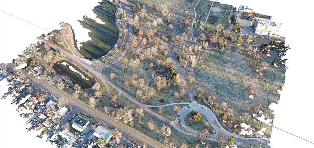
Pulling in point cloud data for a project with the Denver Museum of Natural History. Image courtesy of Daniel Tal.
What inefficiencies has Scan Essentials resolved in your workflow?
To me, the workflow is great when everything can be done in SketchUp, and this integration really allows for that to happen. I save anywhere from a couple of hours to days worth of time by not having to jump between platforms to show point cloud data, and I can have models geolocated and geometrically accurate. Ultimately, being able to stay single-sourced throughout the whole project is a huge benefit.
What benefits have you gained from using Scan Essentials in your workflow?
One of the best things about SketchUp is the ability to bring other models in as reference files—it really makes everything worth it. It is the only platform I know that allows you to import essential data and model from it.
When it comes to presenting projects to clients, we are able to do live presentations right in SketchUp which is great. In our work with federal agencies, we can use their lidar files, manipulate them and incorporate them right into the project.
“It’s incredibly straightforward and saves time for my team and the clients.”
What does your typical workflow look like?
One of my main goals in using Trimble’s technology suite is the ability to leverage ALL the data together to deliver greater value to the client. Using Trimble SiteVision we gather the ground control points we need for the drones.
The drones transverse the site collecting data points, capturing topographic data and precise measurements that enable us to accurately model the terrain. The drone data serves as a viewing and assessment tool which, when incorporated into construction data, enables us to create a full dataset in SketchUp that can be shared with the entire project team.
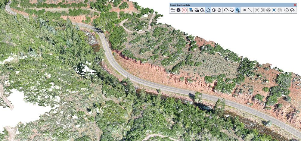
Capturing topographic data with point clouds. Image courtesy of Daniel Tal.
This comprehensive data set allows us to create interpretive graphics, gives us a strong base to kick-off design, and enables us to showcase the before and after of a project.
How do you make the data valuable and affordable?
Well, without the drone data we would have to rely on satellite imagery or a surveyor for aerials, which can take a long time. Now, we get to fly the drone and get aerial and point cloud data for context almost instantly. We can then take this data and use it in our proposal work, showing clients we are ready to start the process immediately.
With scan information, we don’t have to model the context from scratch, it’s already in there. This means that we can quickly go from design, in 3D model or SiteVision, to construction and administration, to post-construction review.
"Ultimately, the point cloud visual is the richest data of all, but the benefits it brings to the whole workflow are invaluable."
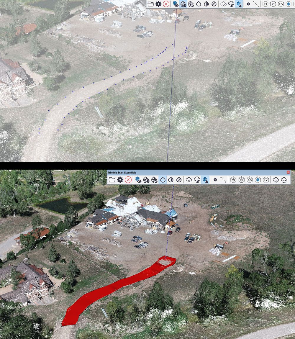
Pulling in point cloud data directly into SketchUp for a residential construction project. With point clouds, the road did not have to be modeled from scratch. Image courtesy of Daniel Tal.
Thanks for sharing your workflow with us Daniel!
We have no doubt that bringing these two platforms together not only increases the value of your Studio subscription but also opens up a world of opportunities within your modeling workflows. We can’t wait to see the incredible designs you create.
Explore Scan Essentials...
To learn how to use it, check out our in-depth course in SketchUp Campus.
Ready to start using Scan Essentials? If you’re already a SketchUp Studio subscriber, simply install Scan Essentials on your Windows machine or Bootcamp on MacOS by going to your Account Management Portal and navigating to Scan Essentials under “My Products”. Once you click download, you will be directed to Extension Warehouse to complete your download.
After you download Scan Essentials, check out some sample point clouds to practice with in your SketchUp model. (Note that these samples are large files.)
Need to upgrade your subscription to Studio? Follow these steps.
As always, let us know what you think about this product update in our forums.
Please note that Scan Essentials is available for Windows users only, and is not available in a SketchUp Studio for Higher Education subscription.


