Paul Lee, a Cork-based architect, and CEO of Viewsion Virtual Environments has worked in digital modeling, architecture, product design, and education for many years. With his background and expert knowledge in SketchUp, he always wanted to create an engaging way to interact with his city’s history and culture using digital tools. We sit down with Paul and talk about how he used SketchUp to recreate Cork, Ireland in 3D.
Tell us about your recent project.
I’ve always been passionate about my hometown of Cork, Ireland and I wanted a way to show it off and help build an engaging experience with it. This led me to kick off the project of creating an intricate 3D model of the entire city.
The first challenge was to create a 3D model of the city center, which meant building a 1 kilometer-radius city model... a huge task. I could have done it all myself, but because I'm a teacher, I gathered together students who needed work experience and I taught them how to create 3D digital models. I tried to make this learning experience fun by having the students collaborate with each other on the final model. Each student modeled a different part of the city, and at the end, we pulled it all together into one model.


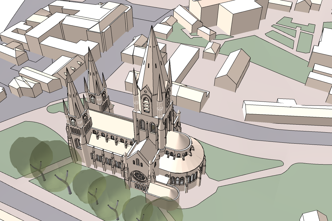
Different views and sections of the historic Cork, Ireland in SketchUp.
What was the typical SketchUp workflow for you and your students? How long did it take to complete?
To start, we took on the simplest tasks first. I asked the students to create geo-models to ascertain the plan and height dimensions of the blocks. The plan data gave us length and width, while Street View data gave us the general height and shapes of the blocks.
Initially, the intention was to create a photo model of the entire city area, but there were a few reasons for opting to create a bare, non-photographic model:
The textures available were of low quality, especially in the narrow streets (angled photos)
Creating neat photo models was a step too far for novices to achieve quality results
I realized that a photo model of such an area decreased clarity rather than enhance it because the model was less like a "map" and more like a game environment
Time limitations
Once that was complete, I tasked each of the students to take a particular city block and model it. The initial models were all done on a flat plane. The ground contours were switched on afterward, and the building blocks were placed in position. The city blocks were then "stitched" together to complete the model. The ground patterns (roads, footpaths, green areas) were incorporated into a separate drawing and integrated with the contours by using the "stamp" sandbox tool.
Then, the final, detailed model was completed by myself. Once the model was complete, I tasked a different set of students to help build the website.
The full project took an immense amount of time. At a guess, it was about 12-to-18 months of work for a full-time, fast modeler.
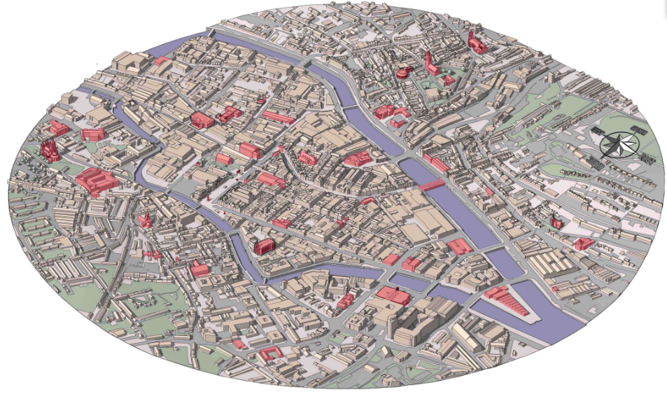
The final 3D model pulled together.
Take it a step further and go inside the model:
What was the end result?
It turned out wonderfully - and the students really enjoyed the challenge. The 3D model has many functions. You can create videos, maps, interactive experiences, and even 3D prints. I created a 3D print of the digital model which is on display in St. Peter's Church, the exhibition centre in North Main Street. It's a circular area about a foot in diameter, but with 3D printing, you can create models of any size. I believe 3D prints will allow visitors to understand the topography of the city and truly see its features.
I also created a new website that showcases Cork City in a way that hasn't been seen previously. Cork.Guide is a 3D interactive map that portrays Cork's streets, architecture, history, pubs, and restaurants with an ever-expanding list of maps to help people find what they are looking for. It’s a unique approach that allows anyone to interact with an image by zooming, panning, and touching.
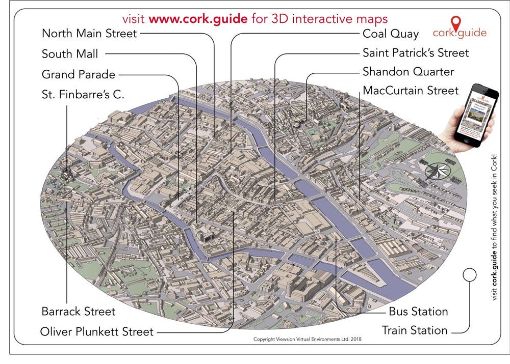
The full map of Cork, Ireland created using a 3D model built in SketchUp.
What are your future wishes for this project?
I’d love to see this strategy of 3D modeling deployed in other cities. This technology can be used for any city in the world. I'm hoping Cork.Guide helps make Cork City more accessible to both visitors and locals. It's taken a lot of late nights, blood sweat, and tears to get it to this stage, but I felt someone needed to do it. My hope is that this resource will help create business opportunities for local traders and help them compete with the challenges of the world wide web.
To learn more about Paul, check out his website and his new books, Rapid Modelling for Minecraft, and Construction Documents Using SketchUp Pro 2020.
Ready to try these tools out for yourself? Trimble SketchUp will give you the confidence to turn those visions into reality. Start a free trial today or find the right subscription for your workflow needs.